

AP Human Geography
The Culture Atlas team is thrilled to introduce the only AP Human Geography supplement teachers and students will need. Thanks to a topic-by-topic overview of the Human Geography curriculum via our Map Chronicles feature, students will be able to reinforce their knowledge of key concepts, and demonstrate their understanding of the course’s key concepts, from migration patterns to political geography to economic development.
Samuel Thomas, a faculty member and AP Human Geography teacher at University School in Cleveland, Ohio, has worked with the Culture Atlas team to compile and create our collection of Map Chronicles for each topic in the AP Human Geography Course and Exam Description. These include a host of related resources he has authored: Quizlets, lesson plans, and general narrative text.
For each topic, we have compiled a host of resources into a Map Chronicle to illustrate the big ideas and help students make connections across the globe. These resources include:
Key terms and definitions for each topic, including a Quizlet so students can test themselves (example: HG 4.1, Introduction to Political Geography)
Hundreds of maps and graphs illustrating key concepts from the class, and driving students to apply them to real-world scenarios
Lesson Plans, with links to additional resources and guiding questions to ensure student understanding
Multiple choice review questions to ensure students fully grasp the major themes of the topic
Culture Atlas is an intuitive way to study geography and history: our 3D virtual globe interface transcends the constraints of 2D textbooks and conventional computer screens, providing users a semblance of the overview effect.
The demo video and images and text below provide a closer look at how our app works and how it can help AP Human Geography teachers and students reach their goals.
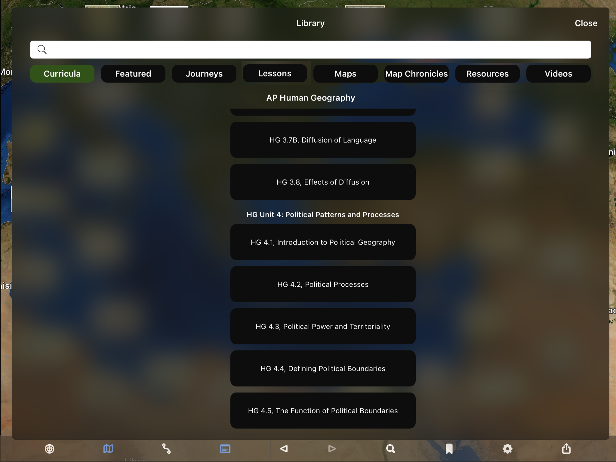
Culture Atlas contains a separate Map Chronicle for each topic in the AP Human Geography curriculum. These are organized numerically in the Library in a scrolling column under the Curricula tab. Clicking on a topic will take students to a topic’s Map Chronicle, as seen in the image to the right.
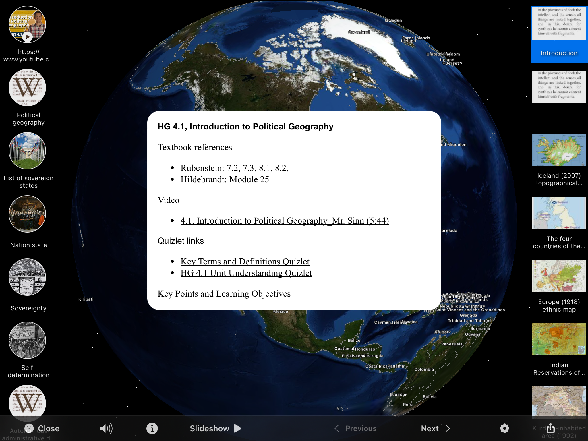
Each Map Chronicle has two introductory text slides, the first of which is shown above and includes: • References to two of the most popular HG textbooks (Rubenstein, Cultural Landscape and Hidebrandt, Human Geography), • A link to the related YouTube video focused on that topic (detailed on the next image to the right), • Links to two Quizlets: Key Terms and Definitions and Unit Understanding (detailed further below), and • A collection of Key Points and Learning Objectives for the Human Geography topic.

The Mr. Sinn Channel is a popular YouTube site with a library of well-produced videos covering each of the 68 AP Human Geography topics. (HG 4.1 video shown in this image.)
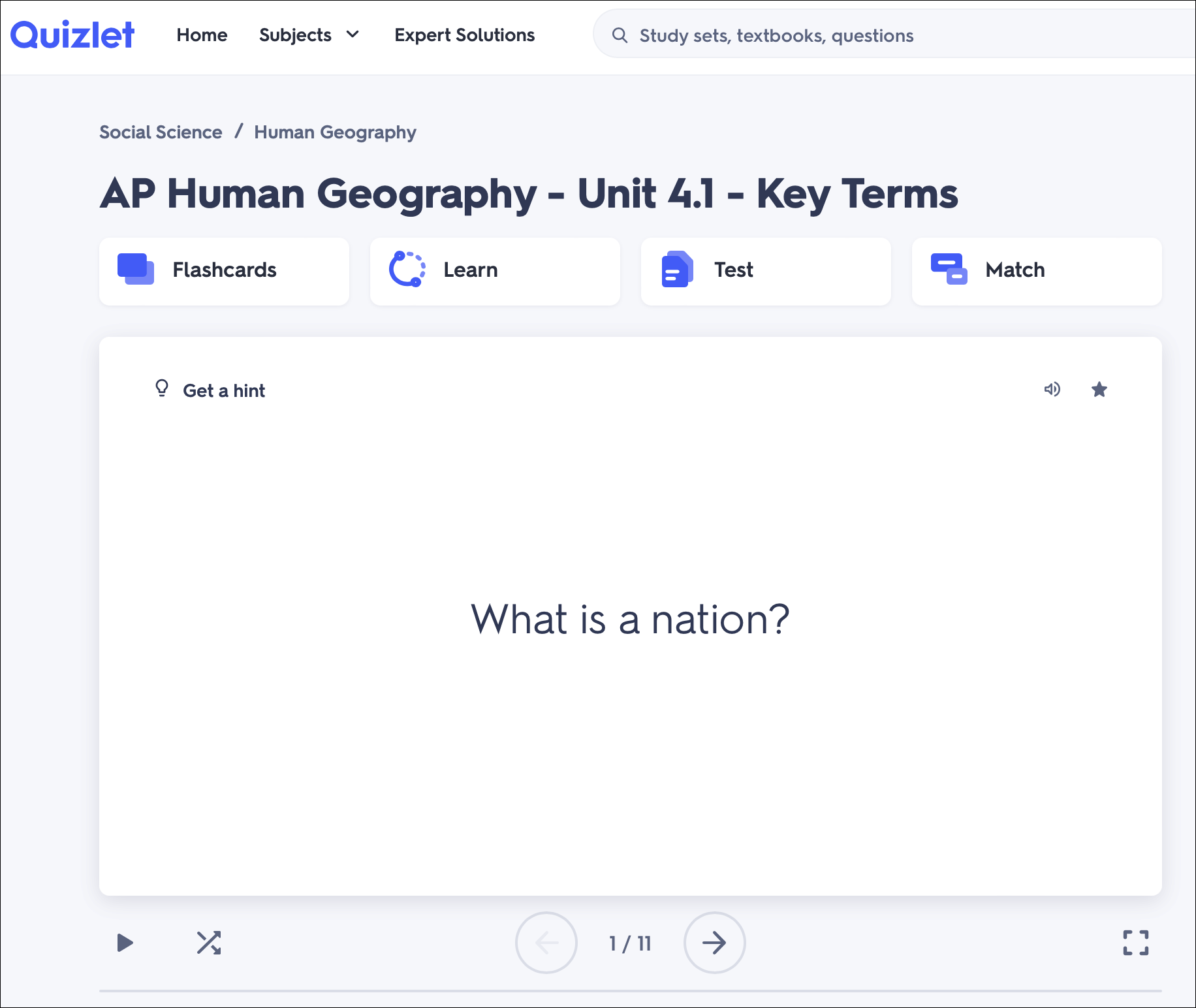
Our Human Geography Topic Map Chronicles also include links (on the first text intro slide) to Quizlets authored by Samuel Thomas: one on Key Terms and Definitions as shown on this image, and another on Topic Understanding.

The second intro text slide has key terms and definitions in the center slide window, which are covered in the related Quizlet link from the first intro text slide.

In this slide we see one of the most remarkable features of Culture Atlas: the use of coordinated maps, to project a two-dimensional map onto the globe. You can see the original 2D image by clicking on the View Original Map icon at the top of the slide. All images are accompanied by text providing context to aid in student understanding.
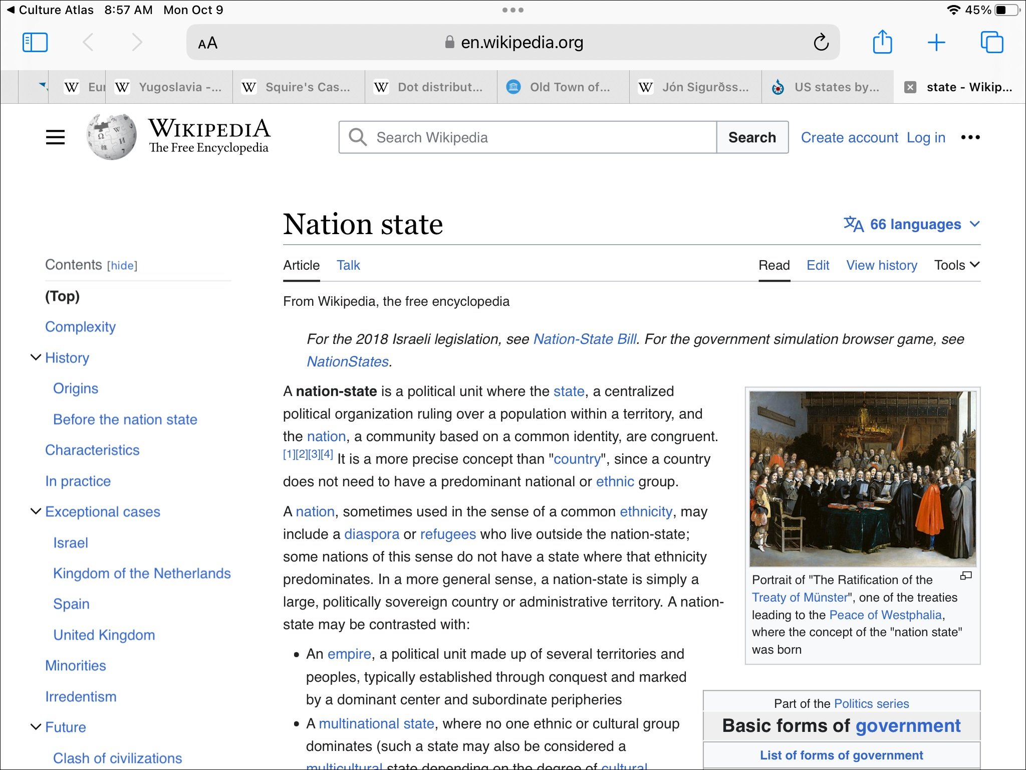
Culture Atlas also allows students to explore topics more deeply, either on their own or as a part of a mini-research project. The map of Iceland would connect naturally to the Wikipedia article “Nation State.” Links to additional information (articles, videos, web sites, etc.) are found to the left of the slide image.

By clicking on the “i” in the bottom Navigation Bar, students can access detailed information about the image, including a full description, contextual notes, image source info, and detailed information about the author.

In this image, we see how coordinated maps work at a larger scale. Here a map of Vatican City is superimposed above it on the satellite imagery of Rome. Beneath the image is an Opacity Bar that allows students to fade-in and -out the map.

Here we see the same coordinated map as above, with the opacity turned down, allowing students to gain a greater understanding of the geographic context. Culture Atlas also enables students to capture text or create PDF files of a map or image they have viewed and share these with others or incorporate them into a separate file for reporting purposes.